ORLANDO, Fla. – A non-tropical low off the coast of South Carolina will help usher in a drier stretch of weather for Central Florida beginning Sunday and into early next week.
This same low (Invest 95L) is also catching the eye of the National Hurricane Center, as they are giving it a 50% chance of further tropical development in the next few days as it approaches the Carolinas.
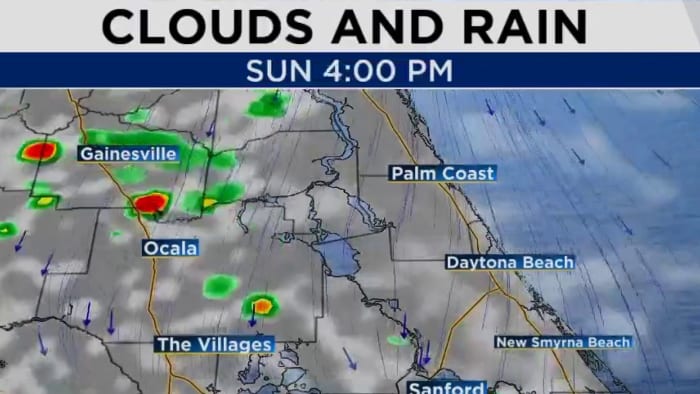
With drier air arriving into east Central Florida, models have trended much lower Sunday with rain coverage at only 20-30%. Any storms that do develop will still have a chance of producing lighting and heavy rain into mid evening.
Highs Sunday afternoon are expected to reach the upper 80s to low 90s with feels-like temperatures hovering above 100 degrees.
[EXCLUSIVE: Become a News 6 Insider (it’s FREE) | PINIT! Share your photos]
The aforementioned low is forecast to churn up the Atlantic and east coast beaches, causing building seas and rough surf. For boaters, small craft should exercise caution this afternoon and beachgoers beware of the high risk of rip currents.
Next week, rain chances will moderate back to normal at 40-50% with a few sea breeze storms possible. Highs through the rest of the outlook remain near 90 degrees.
More Stories Like This In Our Email Newsletter
Get today’s headlines in minutes with Your Florida Daily:


Post comments (0)